Ahmad Qasim Akbar’s (Graduate School of Engineering) paper has been accepted for Geosciences, MDPI.
Congratulations!
Author(s)
Ahmad Qasim Akbar, Yasuhiro Mitani, Ryunosuke Nakanishi, Ibrahim Djamaluddin and Takumi Sugahara
Affiliation
Department of Civil Engineering, Graduate School of Engineering
Manuscript Title
Impact Assessment of Digital Elevation Model (DEM) Resolution on Drainage System Extraction and the Evaluation of Mass Movement Hazards in the Upper Catchment
Abstract
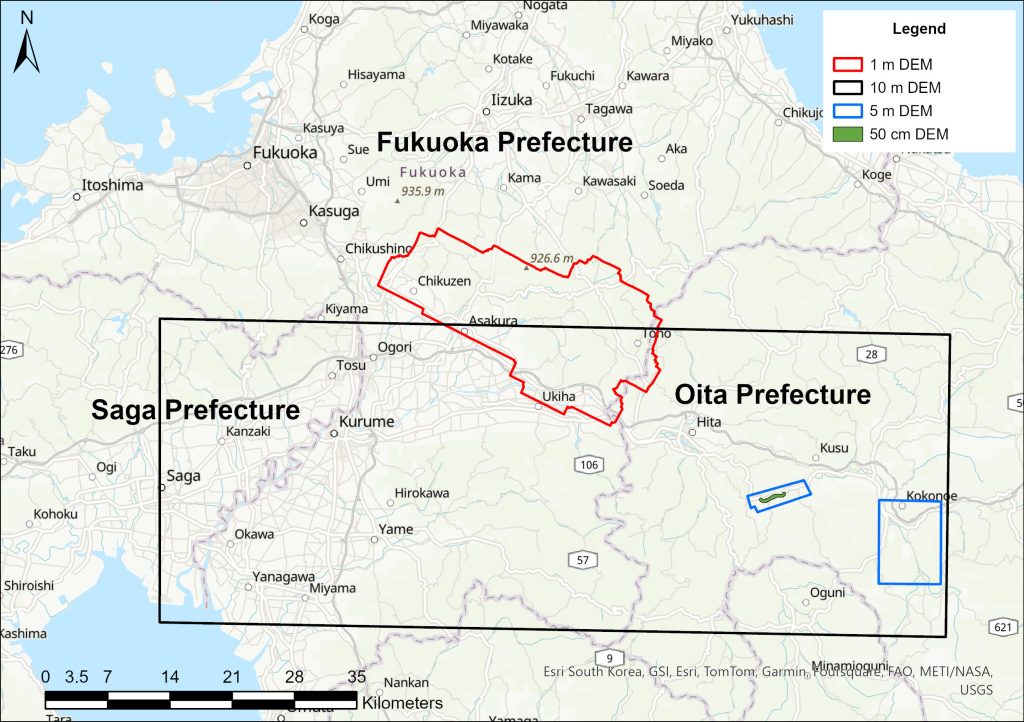
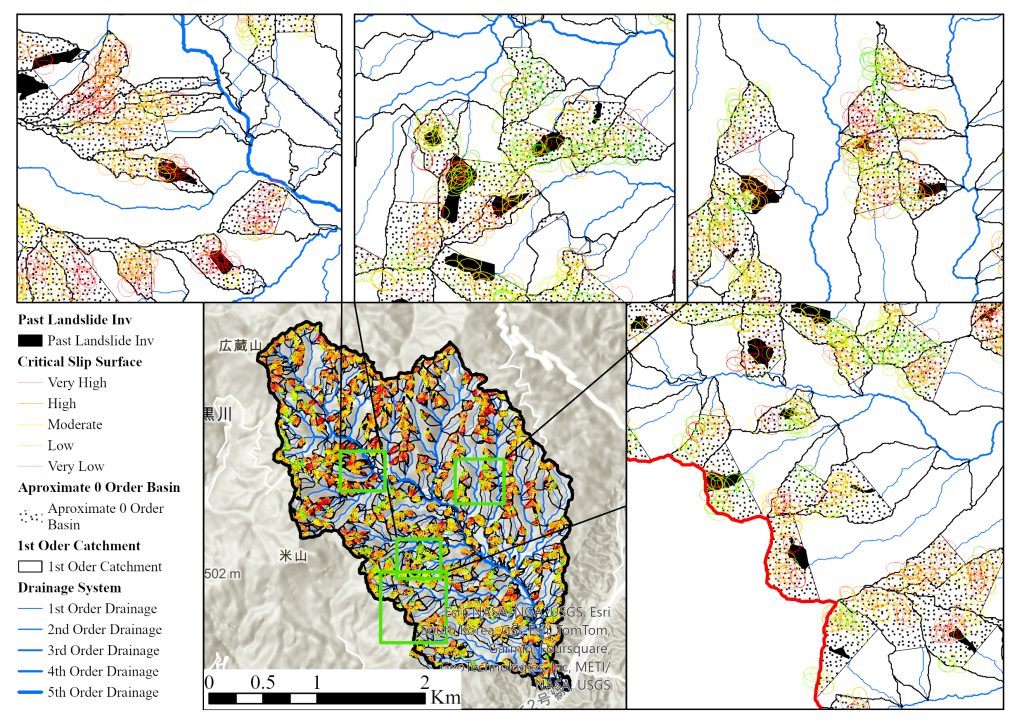
Worldwide, landslides claim many lives each year, with an average of 162.6 deaths reported in Japan from 1945 to 2019. There is growing concern about a potential increase in this number due to climate change. The primary source of shallow and rapid landslides within watersheds is the 0-order basins, which are located above the 1st order drainage system. These active geomorphological locations govern the frequency of mass movement. Despite the recognition of their importance, little attention has been paid to the role of 0-order basins in initiating landslides. Drainage systems can be extracted using the Digital Elevation Model (DEM) in GIS software. However, the effect of DEM resolution on the extraction of 1st order basins remains unexplained. This research develops an algorithm to assess the impact of DEM resolution on the extraction of first-order basins, channel head points, and the identification of approximate 0-order basins. The study includes algorithms to evaluate the correlation between DEM resolution and 1st order drainage system extraction using fuzzy classification techniques for approximate 0-order basins. The algorithm was applied in Toho Village, Fukuoka, Japan, defining the most appropriate DEM and stream definition threshold with an 86.48% accuracy and ±30 m error margin for channel head points. Critical slip surfaces were identified inside the 0-order basins and validated with a landslide inventory map with a 91% accuracy. The developed algorithms support hazard management and land use planning, providing valuable tools for sustainable development.
Journal name
Geosciences, Volume 14, Issue 8
Relevant SDGs
SDGs 9: Industry, Innovation, and Infrastructure; 11: Sustainable Cities and Communities; 13: Climate Action; 15: Life on Land
Comments
This study represents a unique approach to evaluating the impact of DEM resolution on drainage system extraction and landslide hazard management. The integration of fuzzy classification and Monte Carlo simulations is particularly impressive, as it provides a practical tool for understanding critical slip surfaces in the upper catchment area and improving disaster risk mitigation strategies in vulnerable regions.